Bright is easily one of my favourite spots in the Victorian High Country, if not the entire state. While I visit this beautiful alpine town for a whole host of reasons, the clean, crisp air and easy access to nature is right up the top of the list.
With Mount Beauty and Mount Buffalo National Park both within a short driving distance, I try to get in at least one good hike every time I’m in the area. As I’ve discovered on recent trips, however, you don’t even need to get in the car to have access to a highly enjoyable nature walk.
The Bright Canyon Walk starts right in the middle of town, is easy enough that almost anybody can tackle some if not all of it, and is short enough that you can fit it around whatever else you have planned for the day. Full of gold mining history, local bird and plant life, and views of the ever-changing river, it’s a different walk in every season, but offers a lot at any time of year.
Having now walked it multiple times, I figured it was time to put together a detailed guide to help others enjoy this walk as much as I do!
What Is the Bright Canyon Walk?
At its heart, the Bright Canyon Walk is a 3-5km trail along the banks of the Ovens River. For what is a relatively short walk that starts and ends in the middle of town, however, it has a lot going on: scenic views, swing bridges, and a surprising amount of history.
The canyon that was carved out by the river, and gives the walk its name, was the site of extensive gold mining in the mid- to late-1800s. It would have been a very different place back then, loud and chaotic, with prospectors lining the banks and dredges ripping up the river bed.
These days, it’s a quiet, peaceful slice of this lovely part of northeast Victoria. The walk takes you past several interesting historical sites, with information boards explaining what happened nearby and giving context to what you’re seeing. I’m glad I stopped to read these boards: I learned a lot from them!
As well as the sluicing paddocks and tail races (don’t know what they are? You’ll find out along the way!), there’s an abundance of wildflowers along the route in spring and early summer. Orchids, wattle, and mint are especially common. I’ve seen and heard many different species of local birdlife as well, especially towards the far end of the track.
No matter what time of year you visit Bright, this walk is well worth the effort. I’ve strolled along it in on both warm summer mornings and at sunset on a beautiful autumn evening, and loved the experience each time.
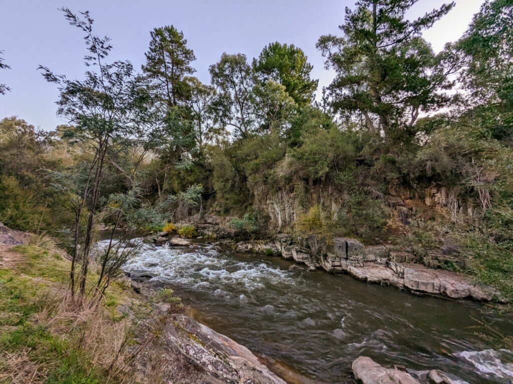
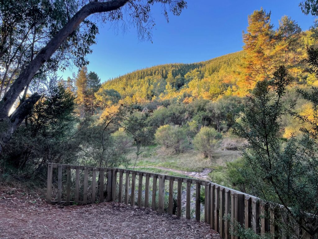
There are a bunch of lookouts along the way, typically with views over the water and along the opposite bank. The river changes a lot as you wander, especially if there’s been a bit of recent rain.
While it was a glorious evening last time I walked it, there’d been heavy rain the previous day, and the rapids were absolutely rushing in one narrow section of the gorge. Other parts of the river, however, were languid and lazy, the water barely seeming to move as it meandered downstream.
Large trees line the trail on both sides of the river, which means there’s plenty of shade on hot days, and shelter from the rain if the weather decides to take a turn for the worse.
Where Does It Start and End?
The Bright Canyon Walk starts on one side of the Star Road bridge in central Bright, and ends on the other. We usually choose to start on the true left side of the river, walking downstream for the first half and upstream for the second, but because it’s a loop track, you can walk it in either direction.
If you’re coming from the main shopping area, you can also pick up the trail from Howitt Park, just behind Bright Brewery. On the other side of the river, the trail starts just over the road from the Bright Riverside Caravan Park.
For a bit of variation, you can also get on and off the track at the halfway mark. A short side trail runs from beside the swing bridge out to the end of Ashwood Ave, where there are a few spots to park the car, and then connects with the Murray to Mountains rail trail. If you’re staying nearby, or just want to try something different, it’s a good alternative route.
What’s the Distance? Are There Alternative Routes?
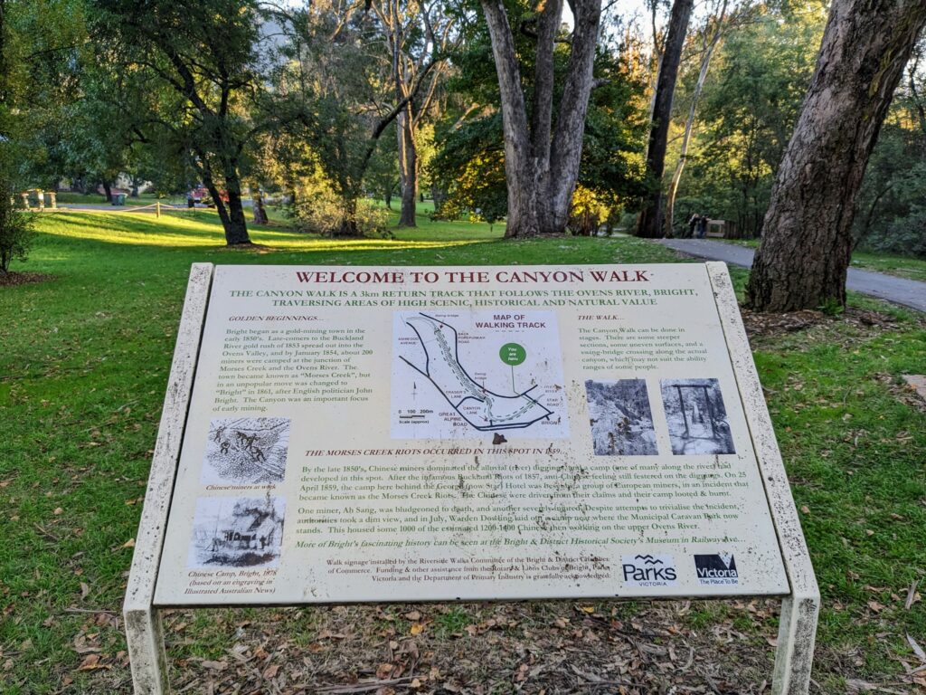
According to the information boards dotted along the path, the Bright Canyon walk is 3km long. That’s about right if you follow the official trail (my GPS measured it at 3.2km), but there are several ways to increase or decrease the distance to suit.
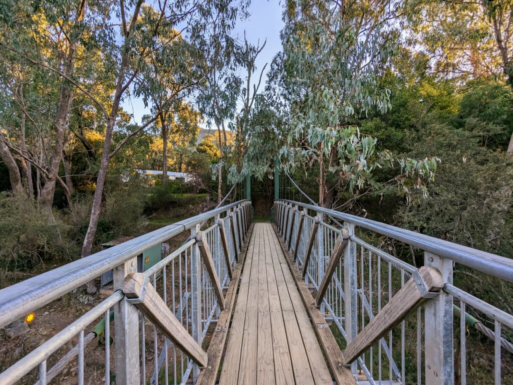
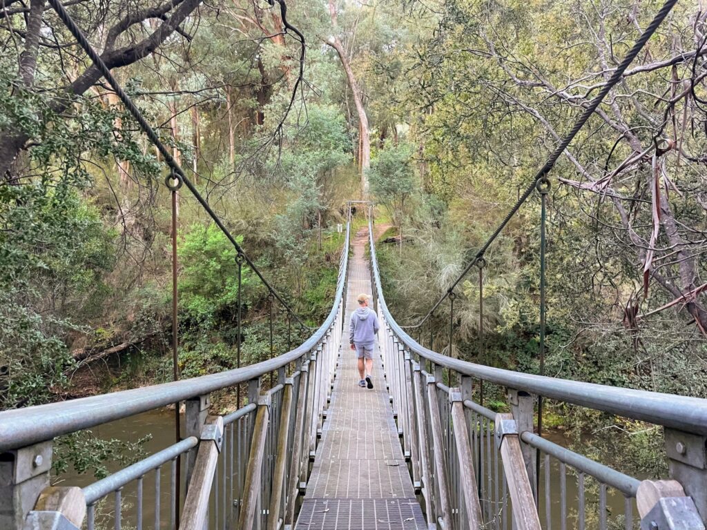
There are two swing bridges that cross the Ovens River: one at the halfway mark, and the earlier Federation bridge that lets you reduce the total distance to about 1.5km. The shorter version is quite flat, sealed on the south side of the river and hard packed dirt on the north.
It’s an easy walk for most people, but if you have mobility issues or after heavy rain, you may want to stick to the paved stuff on the south side and return the way you came.
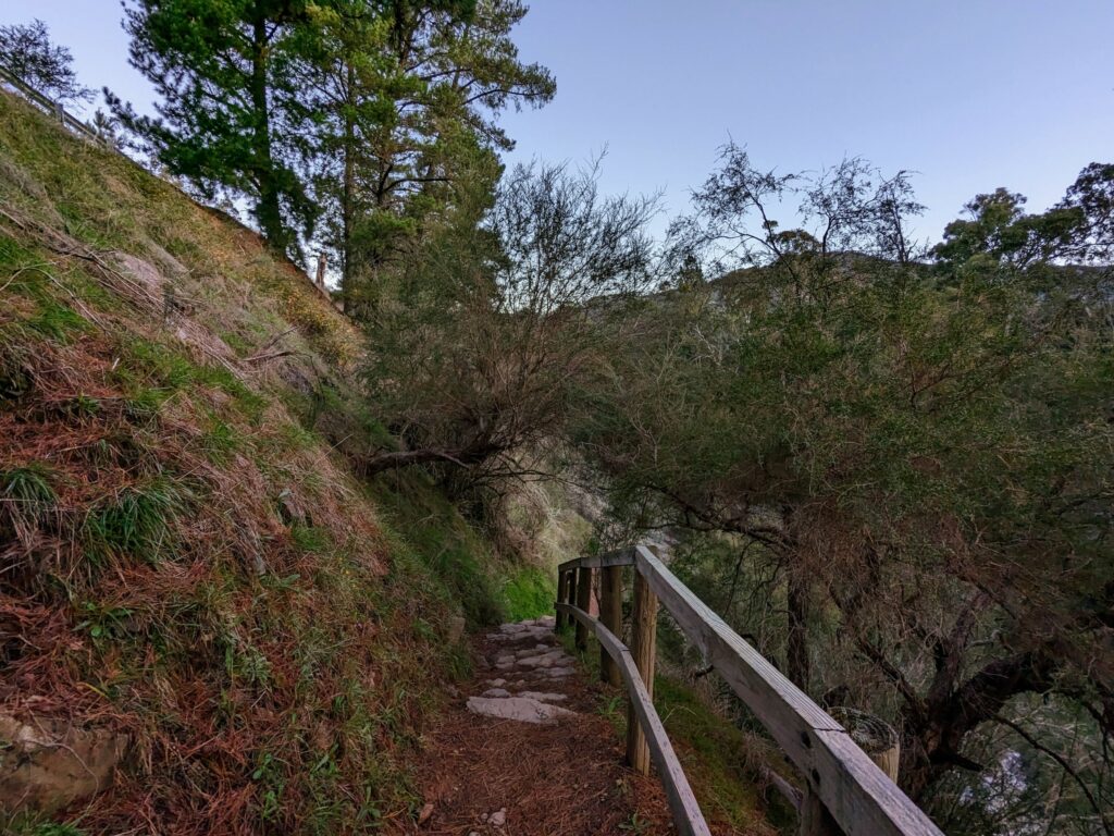
The rest of the track is steeper and more uneven on both sides of the river, but especially the north bank. While I’d still categorise it as an easy walk, at least when it’s dry, there’s a greater chance of slips and trips on this section.
If you’d like a longer walk, you’ve got a couple of options. The trail does continue on past the official start/end point on Star Road: you’ll add an extra 2km if you follow it as far as the pedestrian bridge near Hawthorn Lane before crossing over and looping back, for a total of about 5km.
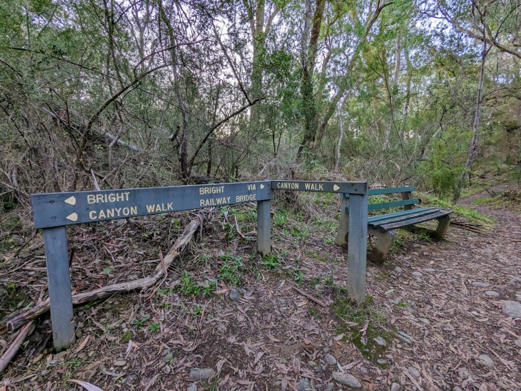
As mentioned earlier, you can also get off the Canyon Walk at the halfway point and return to town via the Murray to Mountains rail trail instead. It’s the path marked as “Bright via Railway Bridge” in my photo above, and makes for a total distance of about 5.5km if you start and finish at Howitt Park. Popular with cyclists, the rail trail section is unsurprisingly sealed and flat.
If you haven’t walked the full Canyon Walk before, I’d recommend doing that before taking the alternate route via the rail trail. They’re both worth doing, but the former is a more interesting route with better views.
I use AllTrails for most of my walking track maps: you can find the rail trail loop on this map, and all of the other options I mention on this one.
How Long Does It Take to Walk It?
We walked 3.5km from Howitt Park to the second swing bridge and back up the other side, and even with stopping for dozens of photos, it took under an hour start to finish. If you only want to walk to the first swing bridge before looping back, it’ll take about twenty minutes in total.
The extension that goes up to the bridge near Hawthorn Lane adds an extra 30-40 minutes to the main trail, for a total of an hour and a half or slightly more. The alternative route via the Murray to Mountains rail trail takes a similar length of time: give yourself around 90 minutes to walk it.
Is It Suitable for Kids?
Depending on the age of your kids, some if not all of the Bright Canyon Walk will likely be suitable for them. The shorter 1.5km section that goes as far as the Federation swing bridge is appropriate for all but very young children, with largely flat, paved or packed dirt trail almost the entire way.
Older kids should be fine with the rest of the track as well, although there are a few slightly steeper bits and some uneven dirt trail. The only real area of concern is about halfway along the northern section of the walk, when the path briefly drops down to cross some rocks alongside the river.
The part you’re meant to walk on is pretty flat, and you don’t have to get particularly close to the water while you do. Even so, because the rest of the rocks slope down towards the river, it’d be possible to fall in if you put a bit of effort into it.
Still, I’d suggest any child that’s happy to walk for an hour without (much) complaint should be able to manage this trail just fine.
Can You Take Your Dog?
Good news for those with canine friends: dogs are welcome on the Bright Canyon Walk, and we met a couple that were happily walking their owners one evening as the sun started to set.
You’re not required to keep them on a leash, but given the number of people you’ll likely meet along the way and the potential for steep drops down to the rocks in the later sections, I’d suggest it’s a good idea.
What Kind of Footwear Do You Need?
This really is a pretty easy walk, and you don’t need anything much in the way of specialised gear. You could walk the first section in pretty much any footwear that wasn’t high heels, but I’d recommend at least a pair of running shoes if you’re planning to tackle the whole thing.
Other than that, it’s just the usual things you’d want for any short walk: hat, sunscreen, and water during warmer weather, and a jumper or jacket if you’re walking on chilly or rainy days.
Are There Any Toilets or Drinking Water?
While there are both toilets and free drinking water stations in Howitt Park at the start/end of the walk, there aren’t any along the trail itself. Make sure to take enough water with you, especially on hot days, and use the bathroom before you go.
A Detailed Guide to the Bright Canyon Walk (With Photos!)
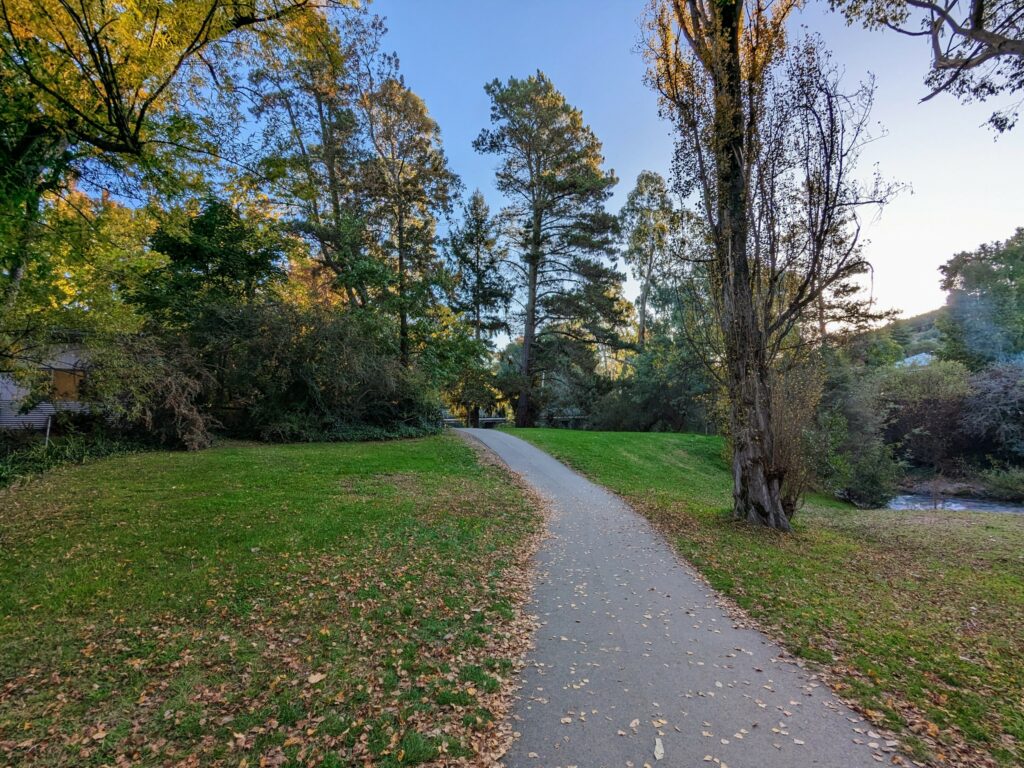
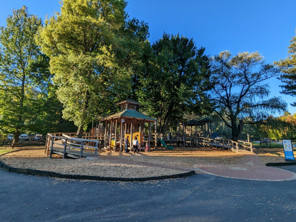
When we walk this track, we usually start and end near the playground in Howitt Park. From there, it’s only a few steps to Bright Brewery, the ideal place for a refreshing beer or wine to cool off. We generally walk it in a clockwise direction, starting on the south bank of the river, and that’s how I describe it below.
The path starts out as paved bitumen as it leaves Howitt Park and continues south. You’ll soon walk under the Star Road bridge, which is the official start/end point of the trail. There’s a painted sign on the bridge warning of low clearance: you’ll likely be fine while walking unless you’re particularly tall, but watch out if you’re biking along here at some point!
Keep an eye out on your left for the first information board, which has a simple route map and track information, along with a wealth of information about the gold mining history of the area. The board is on the spot where the Morses Creek Riots took place amidst a wave of anti-Chinese sentiment in 1859.
The path stays flat and paved virtually the entire way to the Federation swing bridge, about 700m from that first sign. The river at this point is almost as flat as the trail, but you’ll see a few small rapids as you get closer to the bridge. You’re still in town at this point, so expect to share the path with a few cyclists and other walkers.
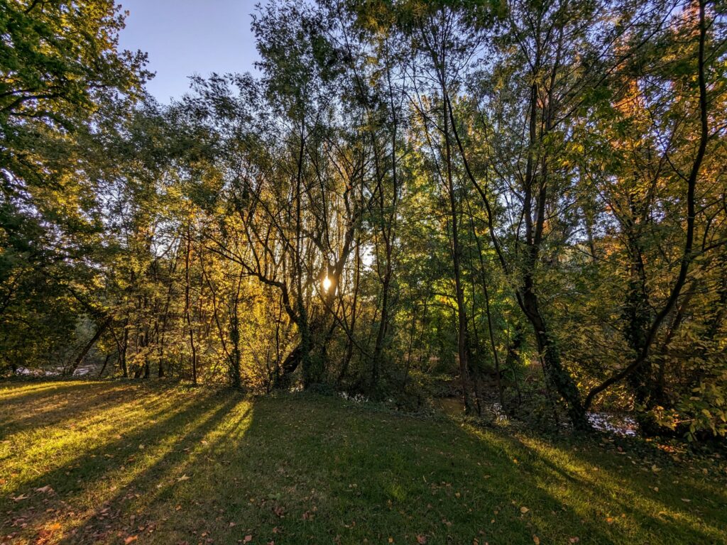
It’s a particularly nice part of the walk if you’re doing it towards sunset, with the sun low on the horizon and peeking through the trees that line the river bank here.
As the river gently loops around, you’ll come to a second information board that goes into more detail about the history of the town and the different forms of gold mining that took place along this river.
From here, it’s only a couple of minutes to the Federation swing bridge. Just before that, the path changes from bitumen to dirt, and you’ll cross a small wooden bridge near a sign that talks about gold dredging history.
This was the most heavily dredged area in Australia, with over 50 machines operating between 1900 and 1955. You wouldn’t know it now: nature has done what it does best, quietly reclaiming the land, but the river’s course was significantly changed in the process.
If you’re only doing the shorter walk, this is where you’ll cross over to the other side of the river and start heading back along the northern bank. Even if you’re doing the full walk, though, it’s worth walking halfway across the bridge to take photos up and down the river before carrying on.
After the bridge, the trail gets steeper and less well-formed. Don’t get me wrong, you’re not scaling mountains or bashing through bush by any stretch, but there are a few sections of lumpy dirt track, rocks, and steps to navigate.
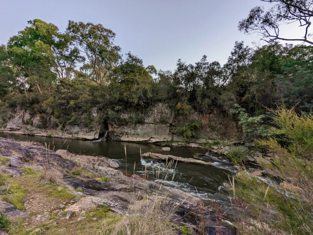
The river gets noticeably swifter here as well: almost immediately after the swing bridge, a few rough steps lead down to the water if you want a closer look. Check out the depth gauges alongside that show just how high the river can get when it’s in flood: I wouldn’t want to be anywhere near it at the time!
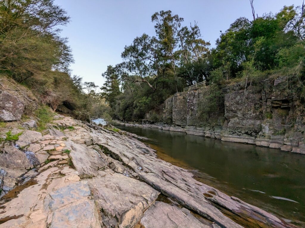
The track rises up a bit from there, which means that a couple of minutes further down the trail, you’ll come to the first proper viewpoint. From here you can clearly see the trail on the other side that you’ll be walking on in about half an hour, along with the layered rocks that make up so much of this part of the river bank.
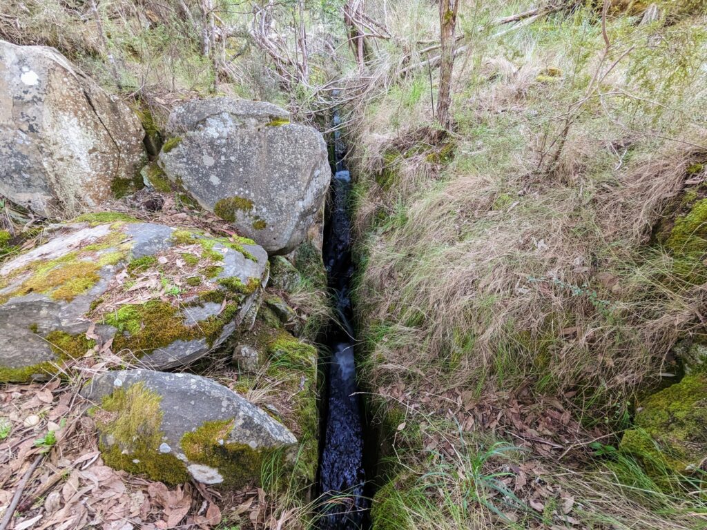
This is also the point at which you’ll start seeing some of the best examples of those tail races I mentioned earlier. These narrow channels in the rock were carved out by miners to help carry away earth and gravel once they’d finished sluicing it for gold, often at some distance from the river itself.
Water rushes through these channels now, often at quite high speed: keep an eye out when you get to the other side of the river for what looks like small waterfalls spraying out from the middle of the bank.
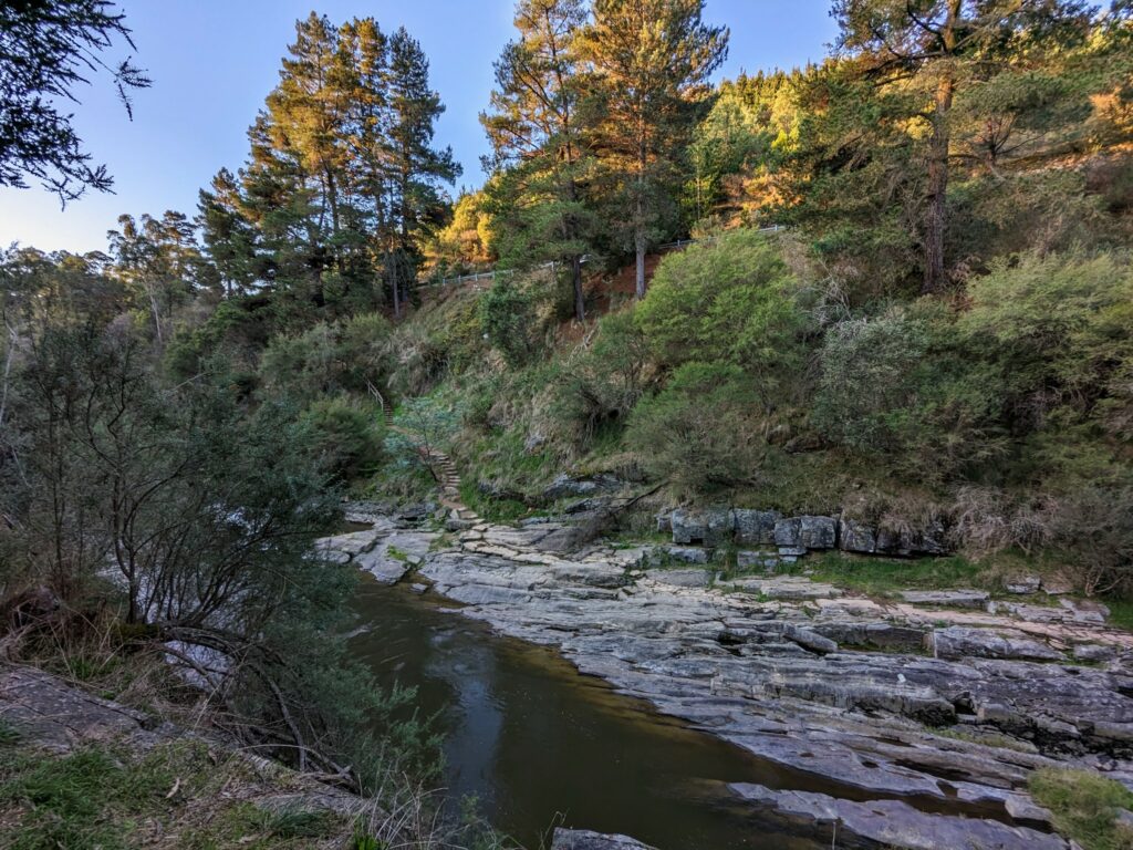
Continue on for another few minutes to the next lookout, where you’ll get a great overview of the flat rocky section of the trail that I mentioned earlier. You’ll need to watch your footing once you get there, but standing safely on this side of the river, it’s just another scenic view on a walk that’s full of them.
As you get close to the halfway mark, the river widens and straightens out just as the path itself becomes narrower and more winding. The rapids from a few minutes ago become nothing but a memory (at least until you go past them on the other side), and the water gets much slower and flatter for a while.
Dodging the occasional tree branch, you’ll soon pass a sign explaining the use of sluicing paddocks, where prospectors sifted large quantities of gravel and dirt with running water to leave behind whatever gold happened to be there. The technique worked remarkably well!
Finally, around half an hour after you set out, you’ll find yourself at the second swing bridge. Unless you’re getting off the trail here to walk back to town on the Murray to Mountains rail trail (another walk that I really enjoyed!), it’s time to cross the bridge and start back on the northern side of the river.
The views from the northern side of the river are at least as good as those from the south, but they’re not the same. The dirt path is quite narrow to start off with, little more than single file, and the forest is initially quite sparse and open.
Before long, though, the path widens out and the forest closes in, cutting off the views to your left. That’s not a problem: the vistas over the river to the right were more than enough for me.
After a delightful few minutes strolling on the hard-packed dirt trail, largely flat other than the odd tree root, it’s time to descend several rocky steps to those flat rocks beside the river that you were looking at from the other side.
If you’ve got kids who prefer to run rather than walk, now’s a good time to get them to slow down for a minute. As I said earlier, while the path itself is pretty flat and not directly beside the water, it wouldn’t be impossible to trip and slide down the rocks into the river, especially after rain.
That bit is over and done with in about thirty seconds, mind you, even if you stop for photos. Which you should, since the views over the river back towards the layered cliffs on the other side are very impressive.
Shortly after crossing the rocks and returning to the dirt trail, be sure to check out the “waterfall” on the other side of the river. It’s actually just the water tumbling out of the tail race you crossed earlier, but it fooled me for a second until I figured out what it was!
A few minutes later, you’ll find yourself back at the Federation swing bridge, albeit on the other side. If you opted to only walk the first section, this is where you’ll pick up the story again.
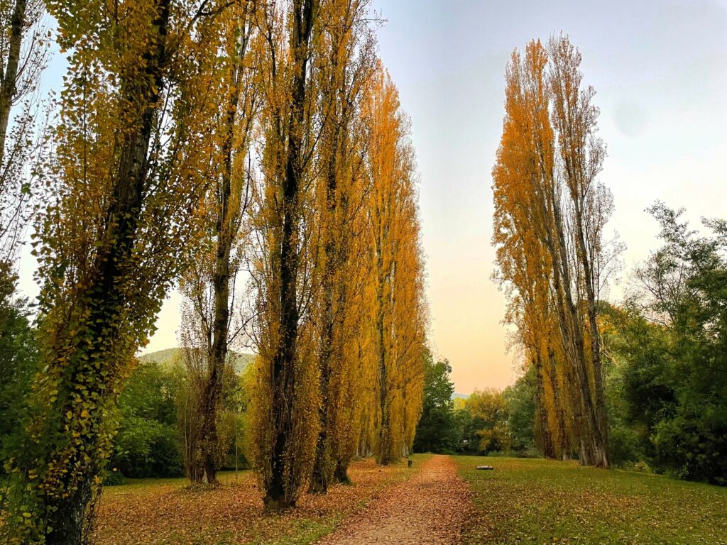
You’re getting close to the end now, with under a kilometre left to go. That doesn’t mean the highlights are over, however, especially if you happen to be walking the track in autumn like we were last time we did it.
That’s because there’s a spectacular grove of poplars that were planted alongside the path in 1960, and now tower high above the trail. They were a riot of colour in mid-April, especially bathed in the golden sunset light. Crunching through the fallen leaves underfoot, it felt like the perfect way to finish off the walk.
From here, it’s only a couple of minutes until you’re back at the Star Road bridge and at the official finishing point. Cross over the bridge, and then return to the Bright Brewery either by the main road or by retracing your steps back to Howitt Park. Either way, you’ll have a cold drink in your hand before you know it!
All images copyright Everything Victoria