There are many things to love about Melbourne and Victoria, but for me, the number of walking and cycling routes is right near the top of the list. From the heart of the city to its outer suburbs, you’re never far from a quiet, car-free path.
Once you get even further out, the options for great hiking and biking trails increase even more. I’ve walked many of them over time, but one I keep coming back to year after year is the Lilydale to Warburton rail trail.
It’s the kind of track that’s easy to love, mind you: easily accessible from the city, well-maintained, manageable by all members of the family (including the four-legged ones), and with great eating and drinking options at both ends.
After another trip out there last weekend, I figured it was finally time to put together a proper guide to it. So here you have it!
A Quick Q&A
Let’s get a few quick questions out the way first, before diving into the detail.
As the name suggests, the trail runs between the towns of Lilydale and Warburton in the Yarra Ranges, 35-75km east of Melbourne.
The trail runs for just under 40km in total, with several places to break the journey along the way. You can find the full route marked on AllTrails, the app I use on all my hiking and biking adventures.
The track surface varies between asphalt, hard-packed dirt, and fine gravel. It’s all suitable for bikes with medium to wide tyres, and good hiking or all-terrain strollers should be fine as well.
There’s no problem with taking dogs on the trail, subject to the usual requirements to keep them under control (it can get quite busy) and just like their human companions, make sure they’ve got plenty of food and water.
Depending on the age of the child and how far you’re planning to go, absolutely. The path is mostly wide, flat (more on that below), and well-maintained, so even little legs should be able to pedal or walk some part of it. There are plenty of bail-out points along the way as well, if things don’t quite go to plan!
Yes, you can rent a standard bike or pedal-assist e-bike from Cog Bikes, with pickup and drop-off in Warburton, Lilydale, Seville, and Mt Evelyn.
Right, on with the show!
What Is the Lilydale to Warburton Rail Trail?
Back in 1965, the 37km stretch of railway between Lilydale and Warburton was officially closed, having operated as a branch of the Lilydale line since 1901. The tracks were ripped up a few years later, but the platforms and land remained, sitting idle until somebody figured out what to with them.
The local government tried to sell off the land in the 1980s and again a decade later, but community opposition and volunteer efforts led to a far better outcome: the creation of a walking, cycling, and horse riding trail along the length of the old line instead.
It’s been maintained and improved ever since, and is now a popular path with locals and weekenders from Melbourne alike. The track largely follows the line of the old railway, passing through or past towns and villages like Mount Evelyn, Seville, Woori Yallock, Launching Place, and Yarra Junction as it runs between Lilydale and Warburton.
Getting There By Car
If you’re coming from Melbourne, it’s very easy to get to either end of the trail. Depending on whether you have the same aversion to paying tolls to multi-billion dollar companies that I do, it takes around 45-60 minutes to drive from the CBD to Lilydale, or 75-90 minutes to Warburton.
As with most driving times, it’ll be dependent on everything from roadworks to rush hour, but you’re at least going against most of the traffic once you leave the central city.
Where to Park
You’ve got a few options about where to park, depending on how much of the trail you’re doing. For those looking to tackle the entire trail, there’s free parking with no time limit on Thomas Ave in Warburton, between the main road and the river. It does get busy, but I’ve always been able to find a park there.
If it’s full and you don’t want to wait around, keep heading east and check out the side streets. Much of the parking on the Warburton Highway itself is metered and/or has a two hour limit. At the Lilydale end, there’s free parking at the train station and on some of the side streets near the start of the trail.
When walking (or only cycling part of the way), Seville is the most obvious place to start or end the day. It’s not exactly halfway, but it’s pretty close, and there’s a lovely cafe in an old railway carriage right beside the trail there for a coffee or something more substantial.
The parking for that cafe is a few hundred metres down a paved side trail, and it’s a good place to leave a car: it’s free with no time limit. I’ve left mine there for several hours without issue.
Finally, if you’re looking to do shorter sections, almost all of the trail hubs at the old train stations along the way have some sort of free parking available. There may not always be a huge number of spaces, but none of them have been full whenever I’ve checked them out.
Getting There By Train and Bus
One of the reasons for the popularity of the trail is just how accessible it is by public transport. The Lilydale line runs from Southern Cross in the CBD to (shockingly) Lilydale, with several stops in inner and outer eastern suburbs along the way. The standard adult Myki fare is $5.50, and the Lilydale end of the trail starts alongside the station.
If you’re starting your walk from somewhere else, the 683 bus mentioned in the next section leaves from beside Lilydale station and services most of the towns and villages between there and Warburton. The main exception is Mount Evelyn: you can get between it and Lilydale on the 679 bus from/to Lilydale instead.
How to Get Back to the Start
Assuming you’re not planning to just turn around and walk or ride back to where you started, you’ve got two choices about what you do when you’ve finished: do a car shuffle, or jump on the 683 bus that runs along the main road between Lilydale and Warburton and back again throughout the day.
The bus has bike racks on the front, and drivers are very used to picking up cyclists (and walkers) along the route. It stops in almost all of the towns along the way: the trail is never more than a few hundred metres from the road, and often much closer. It’s a standard PTV bus, so you pay with a Myki card.
The timetable is a bit variable, with as little as 17 minutes and as much as an hour between buses, so be sure to check the schedule and stops on the PTV site or Google Maps when planning your trip. Still, with plenty of cafes and pubs along the way and at each end, it’s not hard to kill time if you need to!
The first bus leaves Warburton just after 5:30am, and the last departs at 8:25pm. Going the other way, the first departure from Lilydale station is at 6:30am, and the last at 9:40pm.
I’ve used both approaches in the past, doing things like taking a bus from Lilydale station to the nearest stop to the trail in Seville (the one beside the primary school) and walking back to the start, and doing a car shuffle with my cousin for a walk from Warburton to Seville. Both were very straightforward.
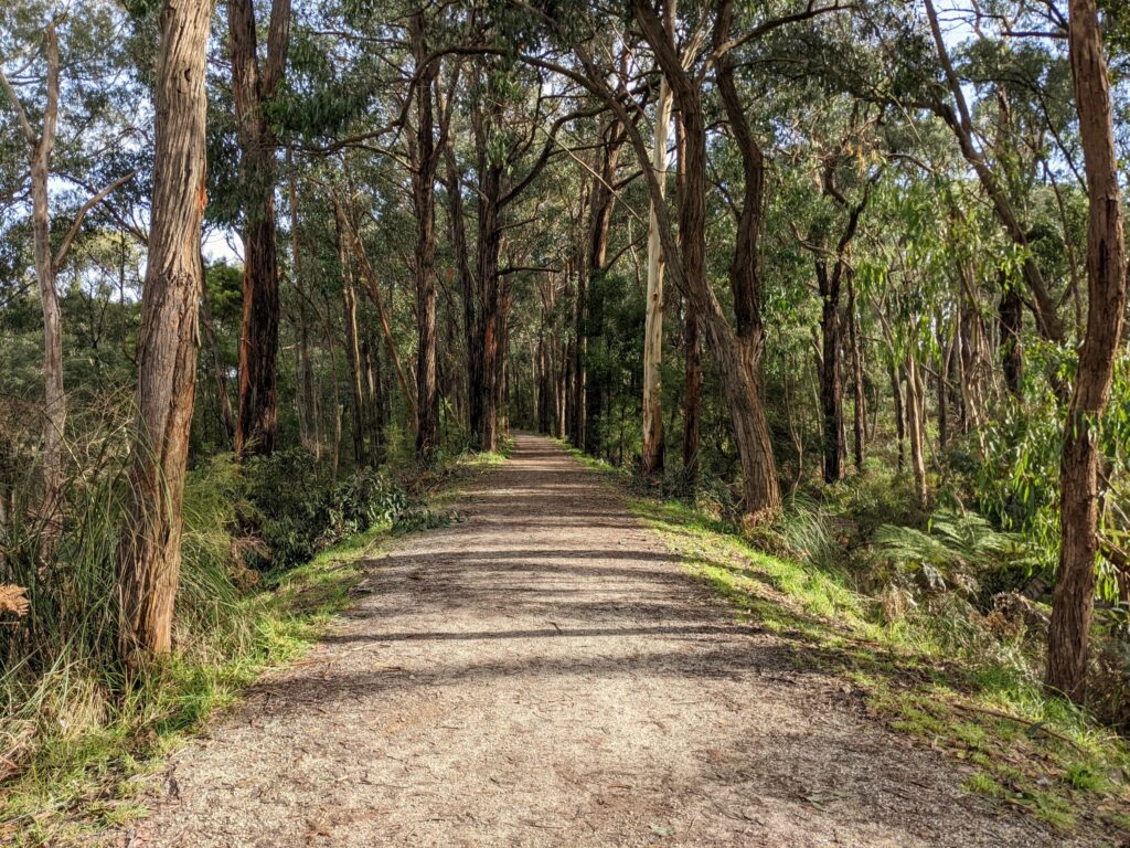
What’s the Track Like?
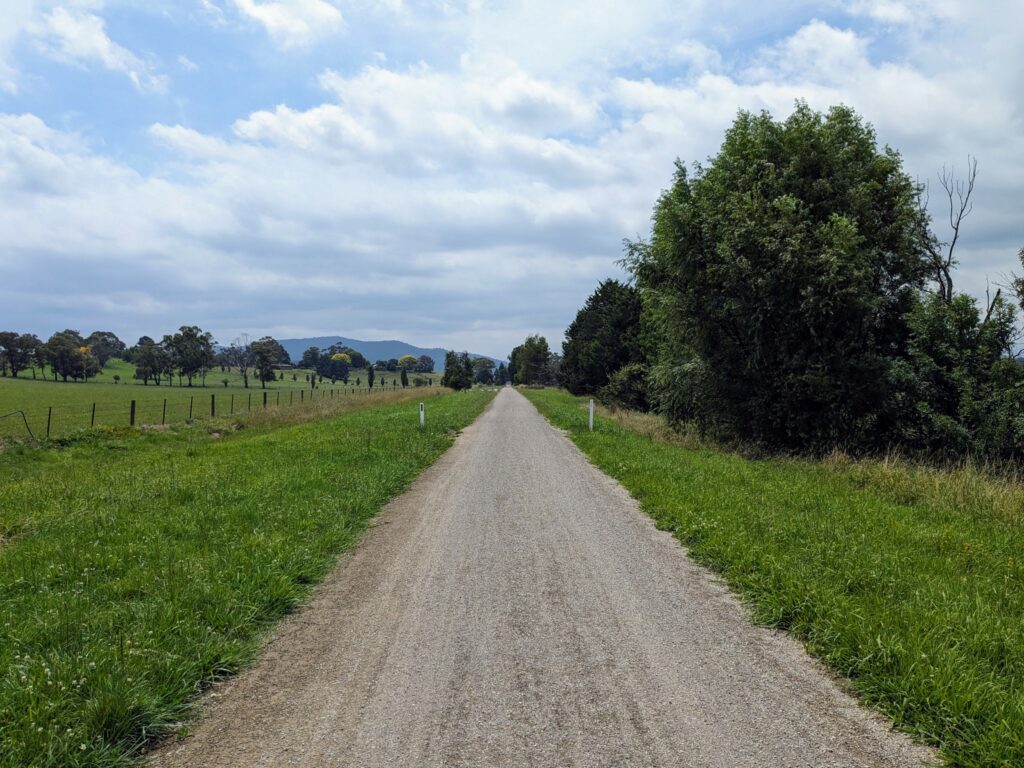
The track is a mix of asphalt, fine gravel, and packed dirt, and is very well maintained. One of the reasons I walk it so often is that it drains and dries quickly: I once walked it the day after a week of rain, and there was no mud or soft bits of trail to be found.
The only (short) steep bit is where the track deviates from the original rail line to go around land that’s now leased by a large secondary school in Lilydale. Other than that, like all good rail trails, there’s little to worry about in terms of ups and downs.
The path climbs fairly gently out of Lilydale, rising about 150m over 5km, and then descends even more gently over the next 15km, after which it stays largely flat the rest of the way to Warburton.
Where to Eat and Drink Along the Way
One of the big benefits of this particular trail is the sheer number of excellent places to stop for food and drink along the way. Lilydale is reasonable-sized town in its own right, with a vast array of cafes, pubs, and restaurants, while Warburton has become a popular holiday spot thanks in part to its gastronomic scene.
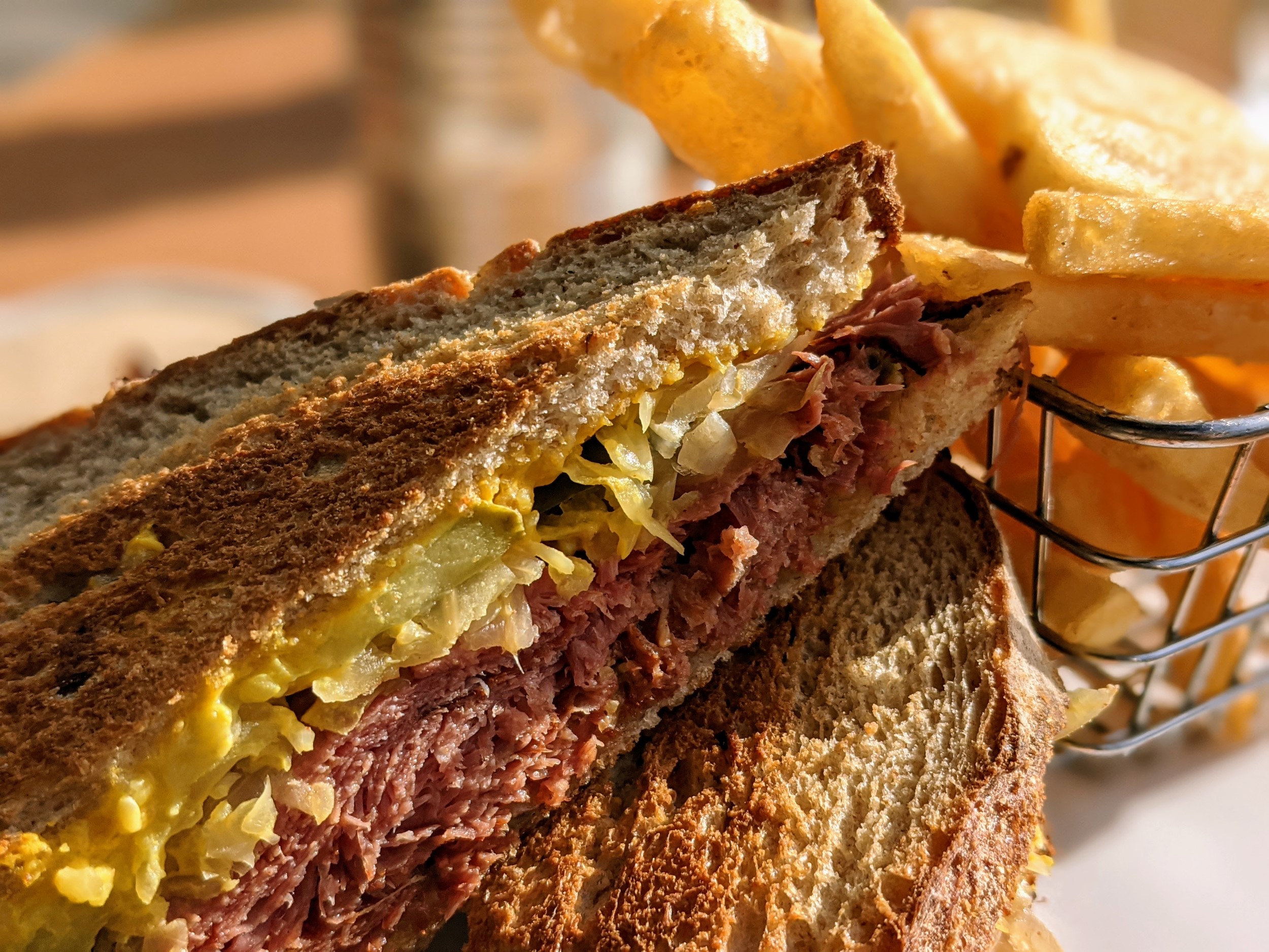
I’ve had a great Reuben sandwich and chips at the Yarra Valley Smokery, just down the road from Lilydale station, while waiting for a train back to Melbourne. The flat white I had at Silva Coffee Roasters in Warburton wouldn’t have been out of place in Fitzroy, and I’ve enjoyed every brunch I’ve had at Three Sugars over the road as well. There’ve been a few.
Even along the trail, though, you’re not short of options. The Carriage Cafe is an obvious stop: I mean, not only is it right there beside the path as you pass north of Seville, but also how often do you get to have a meal in a train carriage that’s memorable for all the right reasons?
The trail runs just about through the beer garden of a great little pub in Launching Place, and there’s a bakery full of all your sandwich and baked goods requirements nearby as well. There are even more choices in Yarra Junction, including the delightful Red Relish cafe beside the trail, and even little Millgrove has a decent fish and chip shop if you’re passing by after lunch.
Can You Do It As a Day Walk?
While the full 40km length is probably a bit far for most sane people to want to walk in a day, you can easily do it over two days. That’s how I’ve tackled it in the past, walking the 24km or so from Warburton to Seville on one day, and 16km from Seville to Lilydale on another. As I mentioned, a car shuttle or the 683 bus make this very straightforward.
If you’re biking, of course, it’s an easier proposition: even at a leisurely pace with a stop for lunch along the way, it shouldn’t take more than four or five hours to get from one end to the other. If you’re really pushing it, you could do it in half that time if the trail isn’t busy.
You can break it up in different ways, though: I’ve split the guide below into five different sections, all of which are accessible by public transport at both ends and can be walked in a couple of hours, give or take. That way, you can decide how much distance you’re up for, and take a bus one way if you need to.
Or, you know, just turn around wherever you feel like it and head back to where you started. There’s lot of options! I’ve written it assuming you’re starting in Lilydale, but you can walk it in either direction, and I’ve generally gone the other way. It really doesn’t make much difference.
Personally, my favourite sections are the ones between Mount Evelyn and Yarra Junction, rather than those closer to either end. They’re all worth walking or cycling, but there’s more countryside and nature in those middle parts, and they often have a few less people on them as well.
Section 1: Lilydale to Mount Evelyn (7km)
The trail starts beside Lilydale station, initially heading north in an awkward loop around the grounds of Mount Lilydale Mercy College that sit over top of the original rail route. This is also where you’ll find the steepest section of track, as it leaves and rejoins the flat rail corridor.
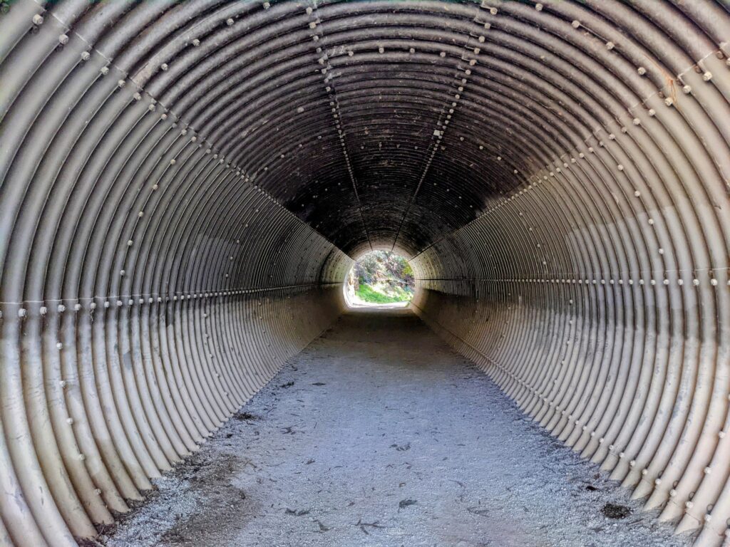
Once that’s navigated, the path heads south over what’s known as the Red Bridge, a pedestrian and cycle bridge that crosses the busy Maroondah Highway, and out of town. There’s a funky-looking metal tunnel that goes under the busy Hereford Road.
This section is the only one with any real gradient to speak of, although it’s still pretty gentle. After the Red Bridge, the trail continues south and east past an owl reserve and on towards Mount Evelyn, climbing about 150m over the six kilometres to the village.
Never fear, there are plenty of cafes around to help deal with the thirst that such a climb might create. Either Passchendaele or the Trail Cafe are the obvious stops, though, as they’re right beside the trail. There’s some parking at the Trail Cafe, and public toilets nearby as well.
Because of its proximity to Lilydale, this is often the busiest section of track with dog walkers, families, and everyone else. It’s still a nice-enough walk, just don’t expect to have it to yourself, especially at weekends or during holiday periods.
If you’re taking the 679 bus to/from Lilydale, the closest bus stop is probably the one on Wray Crescent, just down from Passchendaele cafe.
Section 2: Mount Evelyn to Seville (7.5km)
Things definitely start to feel less built up and more like you’re in nature once you get through Mount Evelyn and start descending again. There’s some lovely woodland as the path meanders through a nature reserve much of the way to Wandin: the old station sign is still there, as it is in most of the towns and villages along the way.
The station has some parking available, but not much else in the way of facilities other than a water fountain: you’ll need to head up to the shopping strip on the main road a few hundred metres away if you want something more.
There are also stops for the 683 bus at both the station and beside the shops, if 11km of walking or cycling feels like enough for the day. Assuming it doesn’t, the path leaves the forest behind once you get out of Wandin, with the countryside opening up into some lovely views across farms and wineries.
That also means there’s not as much shelter from the weather for a while, whether that’s sun, rain, or wind, so bear that in mind!
The forest starts back up again as you get closer to Seville: the path loops away from the highway and around to the north of the town, which means that you can be as much as 20 minutes away from the small cluster of shops and cafes on the main road (and the bus stops alongside).
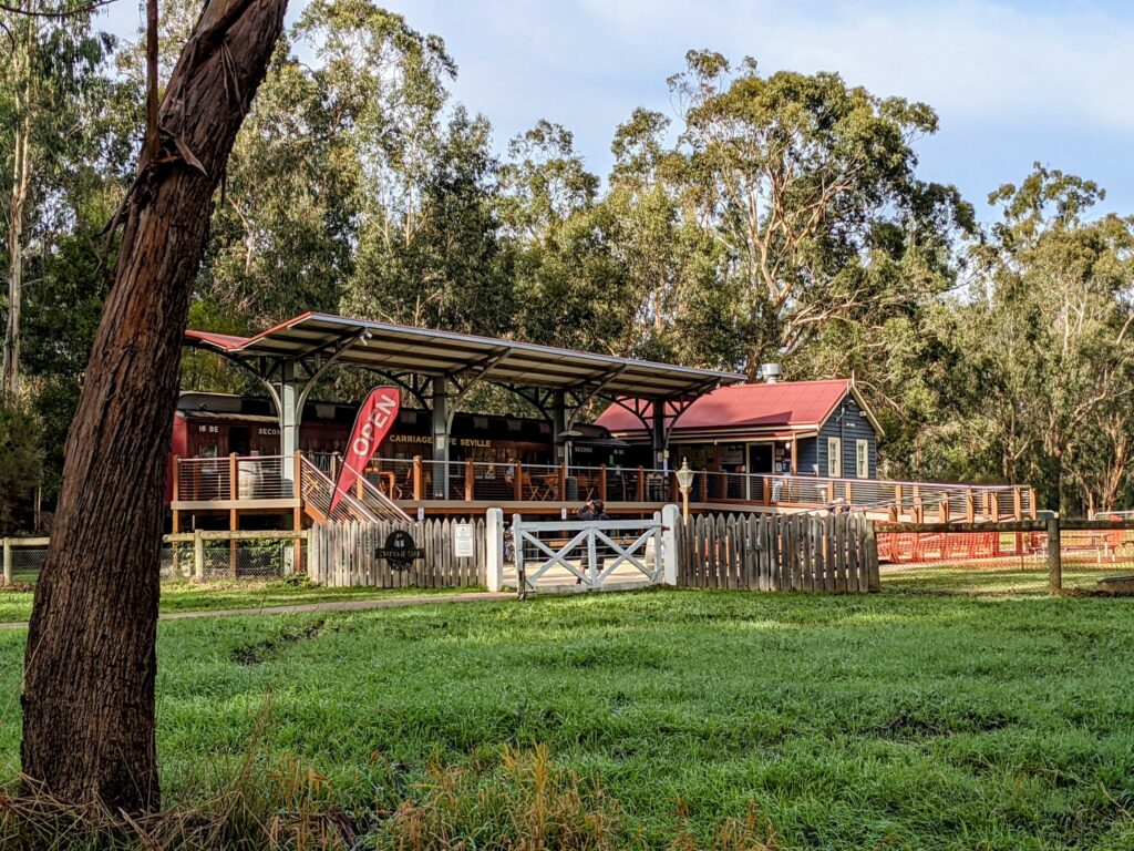
Fortunately, Carriage Cafe exists to fill the void: it’s almost right on the trail, with a good selection of food and drink, and as I mentioned earlier, there’s parking a few hundred metres down a side track where I’ve left my car for most of the day in the past.
Section 3: Seville to Woori Yallock (6km)
One of my favourite sections of the trail is the relatively short stretch between Seville and Woori Yallock. That’s probably because I’ve always found it to be pretty quiet when I’ve walked it, especially the further away from Seville I am.
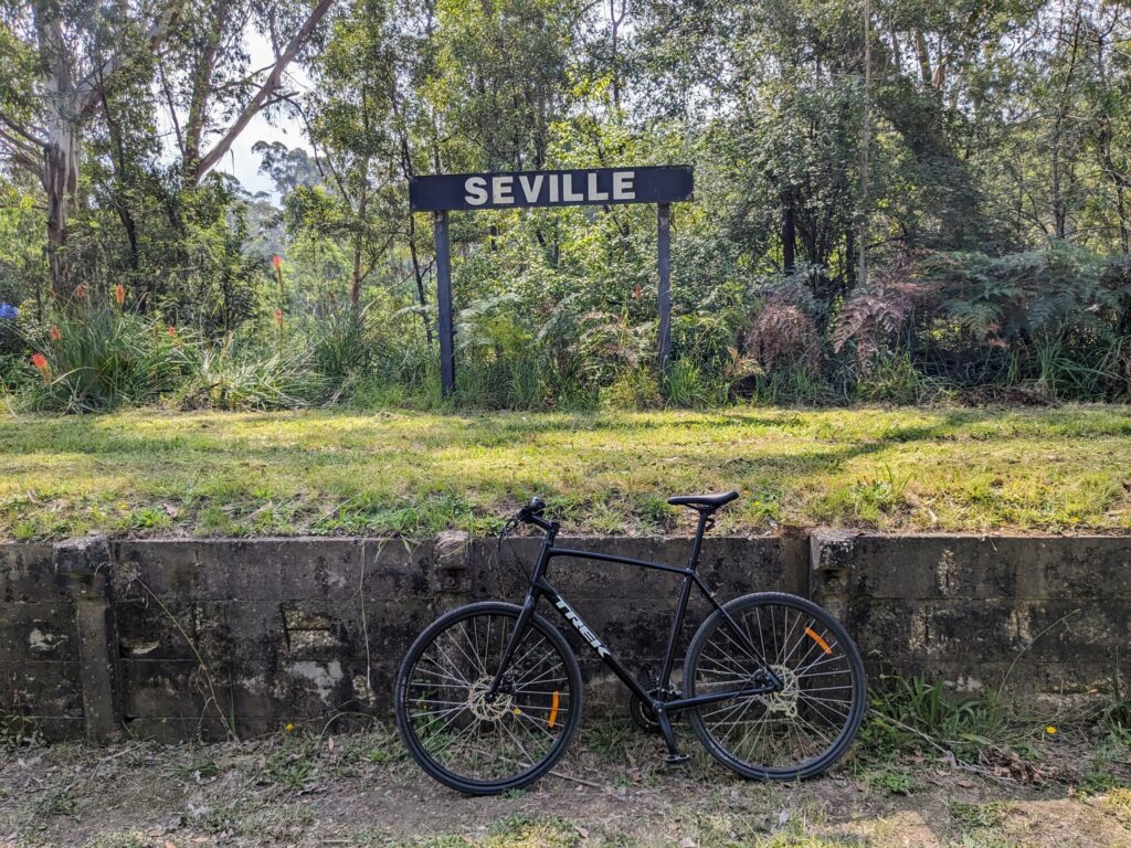
The old Seville station shown in the photo above is a few hundred metres past Carriage Cafe, just after crossing Victoria Road. There’s a water fountain there, and parking alongside.
The trail is entirely dirt and gravel along this section, largely through at least some kind of wooded corridor if not completely forested. It’s a lovely spot to walk or cycle, with plenty of birdsong and few other people to contend with. There are a few gentle curves and it does narrow in a few sections, though, so perhaps take things a little slower than usual if you’re zipping along on a mountain bike.
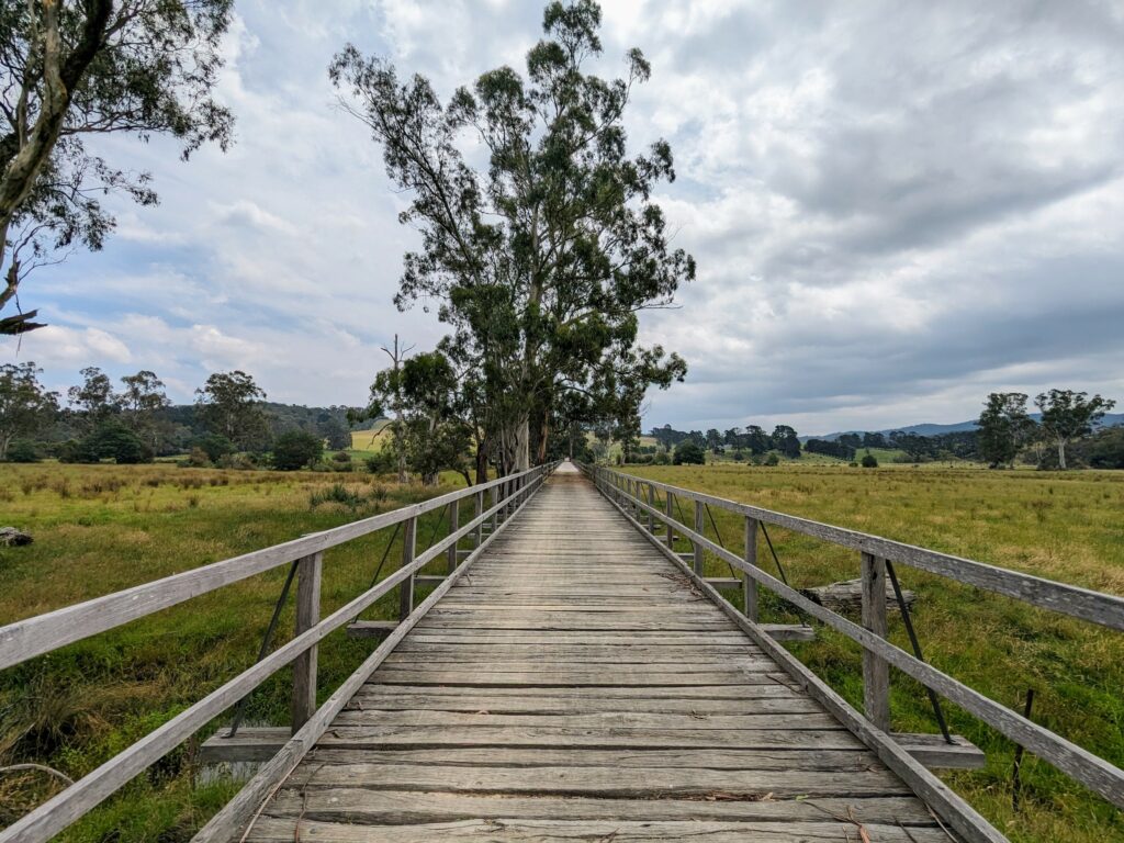
Keep an eye out for the long wooden bridge that’s a feature of this section, soon after the treeline breaks up and you’re back out into open countryside again. It crosses a wide area of swampy grassland shortly before Woori Yallock, and roughly marks the halfway point of the trail if you’re cycling the whole thing.
Once you get to the old station itself, there’s a fairly large car park, along with a series of information boards with photos and historical detail about the local area and the railway. There’s a water fountain alongside, toilets are a five minute walk away near the main road, and there’s a small supermarket and a few restaurants there as well.
If you’re catching the 683 bus to or from here, that’s also where you’ll find it.
Section 4: Woori Yallock to Yarra Junction (8.5km)
The open farmland continues on past Woori Yallock, with great views out towards Mount Toolebewong. This is where you’ll want to slap on plenty of sunscreen, especially in summer: there’s little shade on many parts of this section.
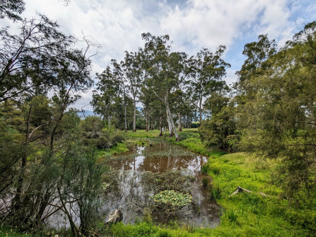
Especially after a bit of rain, there’s plenty of water around here: the Yarra River is quite close to the trail at some points, and it shows, with plenty of creeks and billabongs, and more lush countryside than you get on many other parts of the track.
Before long you’ll find yourself in wonderfully-named Launching Place. I always thought it was called that because it was where people launched small boats into side channels of the Yarra before heading out into the main river, but apparently it comes from the area’s logging history: trees were felled and “launched” from here to float downriver to sawmills in Melbourne.
Regardless of where it got its name from, it’s a good spot to launch yourself into a cold drink: the Launching Place Home Hotel is directly beside the trail, just after it crosses the busy highway at the traffic lights. The 683 bus stop is just past the pub, so it’s a good place to wait! There’s quite a large carpark behind the General Store.
From here, it’s only another couple of kilometres to Yarra Junction. It’s a reasonable-sized town, and because the trail runs close to the main road at this point, it’s easy to break off for food, drink, or anything else you need.
Be sure to check out old station here: it’s the original one from Lilydale, that’s now been turned into a museum. You won’t be able to go inside unless you’re passing by on a Sunday afternoon or public holiday, but you can still peer through the fence!
There’s lots of parking nearby, plus toilets right beside the trail. The 683 bus stops in several spots along the highway here.
Section 5: Yarra Junction to Warburton (9km)
Onto the final stretch now, and it’s a good one, especially the first half as far as Millgrove. That’s also where the unsealed track ends: the last few kilometres into Warburton are all on asphalt.
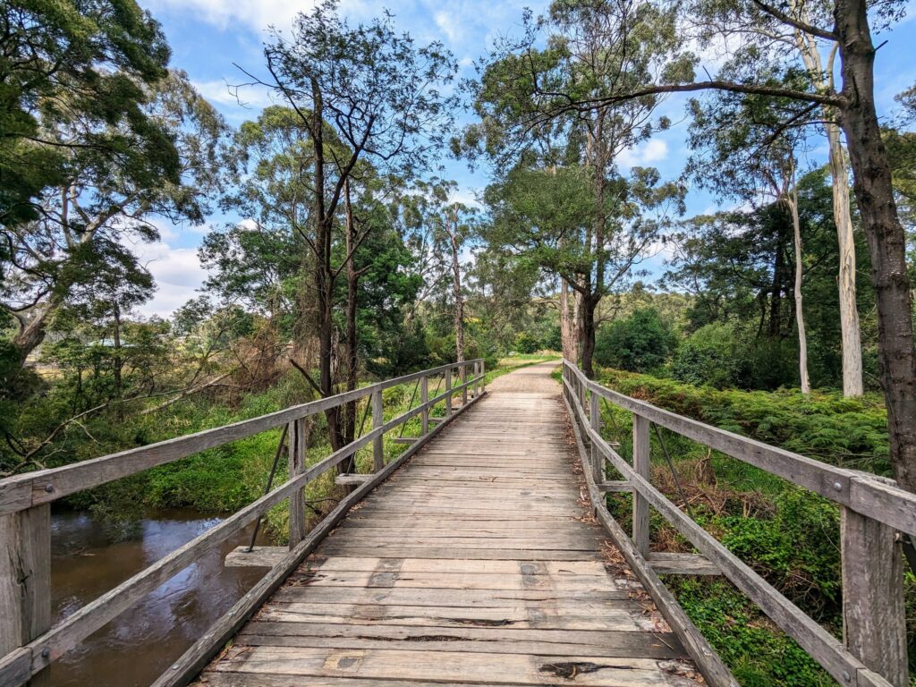
Before that, though, there are some great old wooden bridges to cross, bushland to admire, and sweeping views when the tree-lined sections of trail give way to open farmland. You don’t have to wait long for the good bits, either: I took the bridge photo below barely outside Yarra Junction, but you wouldn’t know.
Millgrove is pretty small, but there are still public toilets available beside the trail, and a bus stop if you can’t make it the last five kilometres or so into Warburton.
Perhaps unsurprisingly, like the section closest to Lilydale, this last bit of the trail can get pretty busy. I last walked it on a weekday just after New Year, and the stream of bikes and runners was pretty constant for the few kilometres closest to Warburton in particular, where the track can also be quite narrow in parts.
Even so, it’s still an enjoyable walk, if a bit more manicured than some of the bushland and wooded sections you’ve ridden or walked through earlier in the day. Once you get back into Warburton itself, drop down off the trail back to the main road for all of the food, drink, and transport options your tired legs could hope for!
So there you go, my guide to walking or cycling the Lilydale to Warburton Rail Trail. Let me know if you found it useful, or if there’s anything else you’d like to know about it: always happy to help if I can!
All images copyright Everything Victoria